| ap_world_regions.pdf |
|
People Barron's
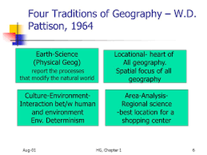
Eratosthenes - early cartographer, coined the term geography, made a nearly accurate measurement of the Earth's Circumference Ptolemy - early cartography, used a grid system George Perkins Marsh - wrote about how human actions change or affect physical/natural systems Carl Sauer- cultural landscape is the fundamental unit of geographical analysis, this is from human interaction with physical environment, ALL landscape is effected by humans W.D. Pattison -geography comes from 4 traditions: earth science, culture-environment, locations, and area-analysis. Map Parts
absolute location - exact position on a map grid system longitude/meridians- lines to the east or west of the Prime Meridian, run vertically latitude/parallels - lines to the north or south of the Equator, (go horizontally) Prime Meridian-0 degree line of longitude through Greenwich, England International Date Line -180 degree line of longitude, starts a new day Equator - 0 degree line of latitude, separates northern and southern hemisphere coordinate system - grid (longitude and latitude) used to find absolute location |
Maps Types to know!variables in a specific area
Thematic Maps - type of map that attempts to display one or more
cartography - the science of making maps
cognitive/mental map - map drawn from one's memories and experiences
location charts - map, chart, graph, etc that show statistics of a particular place
Thematic Maps - type of map that attempts to display one or more
cartography - the science of making maps
cognitive/mental map - map drawn from one's memories and experiences
location charts - map, chart, graph, etc that show statistics of a particular place
Azimuthal Projection - flat constructed map of a particular area (often poles) with correct direction and evident circles for scales
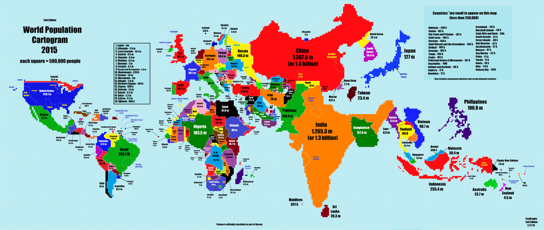
cartograms - thematic map where the unit is shown larger due to importance than actual size
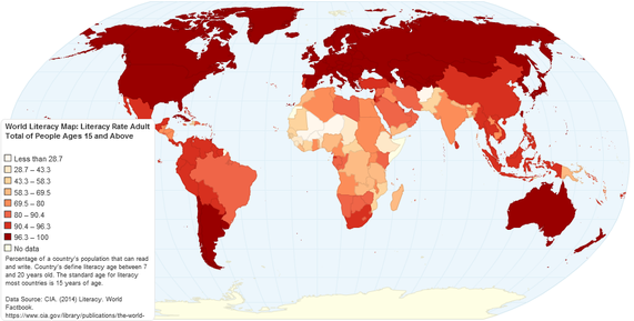
choropleth map - thematic map that uses colors of tones or such to represent a particular data
dot maps - shows a thematic map with locations marked of a particular idea or occurance
Fuller Projection - map where all land is show at accurate size an scale to one another but cardinal directions have no meaning (cardinal directions are east, west, north, south)
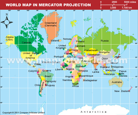
Mercator projection - cylindrical map projection, maintains true direction but distortion increases nearer to the poles
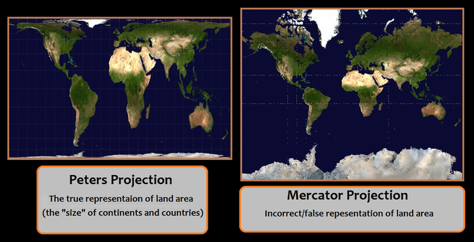
Peters Projection - map centers on Africa, attempts to give true area to all land masses
Robinson Projection - map projection that is not accurate to any one proportion or size, etc but minimizes as errors on all fronts as much at possible
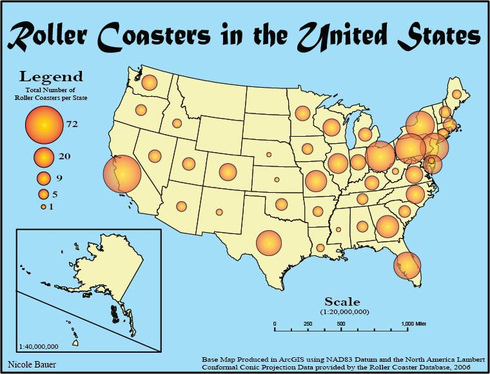
Proportional Symbols Map - thematic map where size of symbols denote importance or size of the given attribute
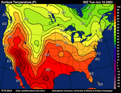
Isoline maps - has lines used to show areas that are relatively equal
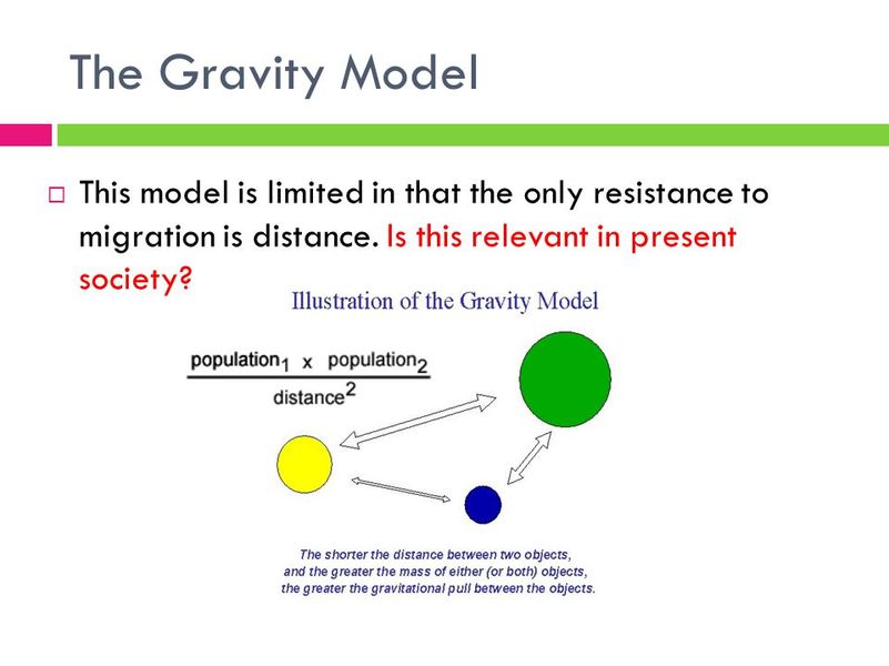
Newton's model of gravity is used to explain how much interaction there is in cities using size (mass) and distance (pull)
