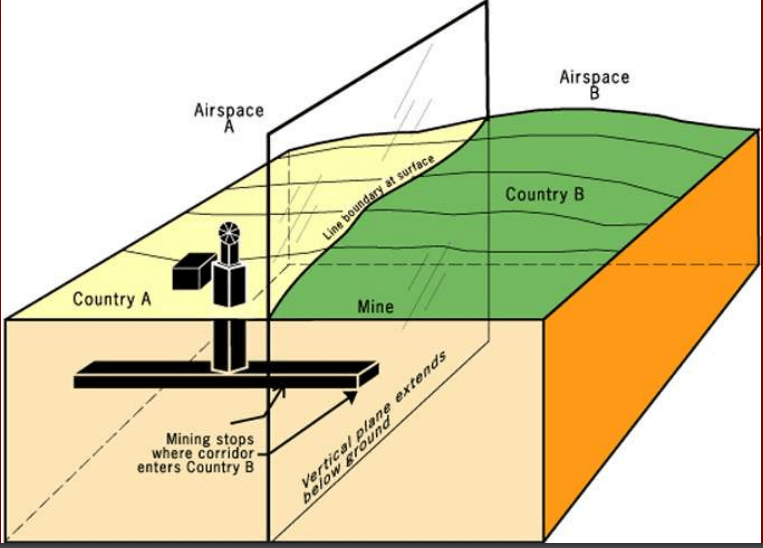
Boundary – a vertical plane that cuts through the rocks below and the airspace above, dividing one state territory from another
Therefore, we aren’t just talking about the signs we see that separate states; we are talking about airspace, water, minerals, resources, etc.
Therefore, we aren’t just talking about the signs we see that separate states; we are talking about airspace, water, minerals, resources, etc.
Establishing a boundary includes four steps
1) States define the boundary through a legal document (by listing actual points in the landscape or by using latitude & longitude)
2) Cartographers delimit the boundary by drawing it on a map
3) States can demarcate it---marking the boundary(pillars, fences, walls, etc)
4) States must administrate it-determine how it will be maintained, how goods & people will cross it
TYPES OF BOUNDARIES
1. GEOMETRIC: Using latitude/longitude lines, township/range lines
Ex. US/Canada, Alaska/Yukon, Chad/Libya
2. PHYSICAL: Follow an agreed-upon feature in the geographic landscape (river, crest of a mountain range, sea, etc)
Ex. Rio Grande River-Texas/Mexico, Andes Mountains-Argentina/Chile, Sahara Desert- Algeria, Libya, & Egypt in the North, Mauritania, Mali, Niger, Chad and Sudan to the South
3. CULTURAL: religious, language, etc., often inaccurate
Ex. Pakistan/India (religious), Ireland (religious to an extent),
Post WWI: Bulgaria, Hungary, Poland, Romania (language based)
Cyprus: "Green Line", island in the Med Sea Greek and Turkish, closer to Turkey but 78% Greek, north mainly Turk, South mainly Greek
****With so many different boundaries, it leads to a situation where there are states with many different shapes
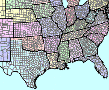
Geometric by township lines
|
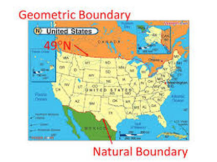
Geometric by 49 Parallel
|
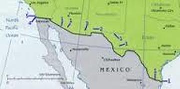
Rio Grande is a physical-political boundary
|
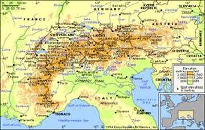
The Alps border France and Italy
|
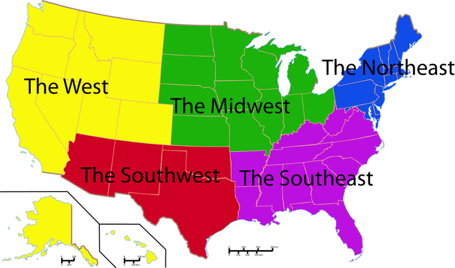
Looking at this map, which part of the US has the largest number geometric boundaries? This is how the US was settled. Why is this area the most geometric?
Looking at this map, which region of the world has the largest number geometric boundaries? Why is this area the so geometric?
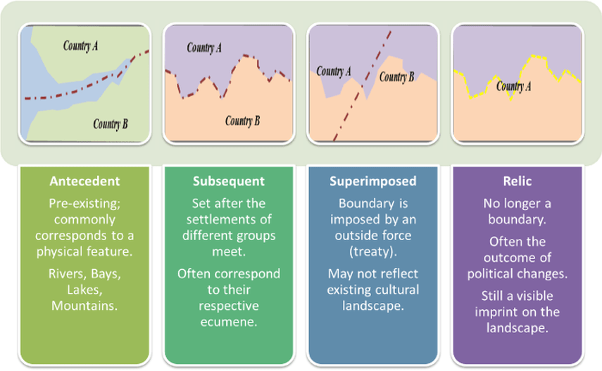
Another way to classify boundaries depends on how they were evolved
|
Antecedent: existed before human cultures developed (example: a river)
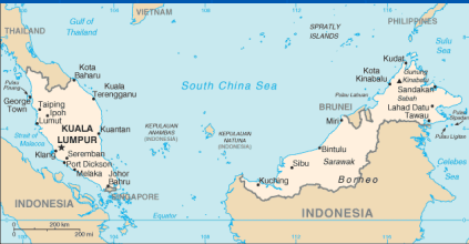
Examples: .Malaysia/Indonesia on the island of Borneo. The boundary passes through a mountainous, sparsely inhabited rain forest where there is a break in settlement. Himalayan Mts between China and India Pyrenees Mts between Spain and France |
|

|
Subsequent: settlement happens, then a boundary is drawn(example: U.S./Can. Border,) often from conflict
(China/Vietnam, Germany/Poland, Northern Ireland/Ireland) |
|
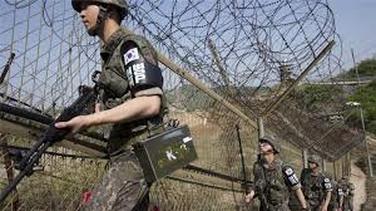
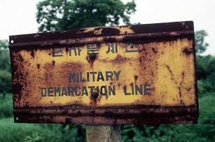
Superimposed: forcibly put on a landscape by outsiders example: Israel border, North and South Korea |
|

Relict: no longer functions, but used to (example: Berlin Wall, Great Wall of China)
boundary delimitation: The process in which cartographers put the boundaries on the map.
boundary demarcation: physically marked with steel posts, concrete pillars, fences or another visible mean.
boundary demarcation: physically marked with steel posts, concrete pillars, fences or another visible mean.
boundary demarcation
|
boundary delimited
|
Frontiers: area where no one state exercises complete control
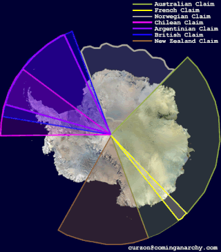
Frontier Claims on Antarctica
|
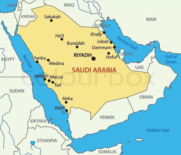
Frontier: Arabian Peninsula (Saudi Arabia and UAE, Oman, Yemen)
|
SHATTERBELTS: area that is unstable b/c it is between 2 very different regions.
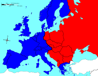
Shatterbelt Ex. East & West Europe
(Orthodox & Roman Catholic; Communist & Capitalist)
|
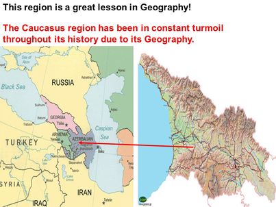
Shatterbelt Ex: Caucasus Mountain Region
|
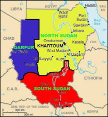
Shatterbelt Ex: Sudan
|
Irredentism: the doctrine that area should be controlled by the country to which they are ethnically or historically related